

/ Overview /
Turning Geospatial Data into Actionable Intelligence
PertSol’s AI-ML Based Location Intelligence Platform empowers law enforcement agencies, intelligence organizations, and emergency services providers with real-time geospatial intelligence, predictive analytics, and advanced location monitoring capabilities.
By combining AI, machine learning, and multi-source location data, the platform transforms raw geospatial information into actionable intelligence, enabling faster investigations, enhanced situational awareness, proactive threat detection, and informed operational decision-making.
/ Challenges /
The Rising Need for AI-Driven Location Intelligence

Massive Volumes of Geospatial Data
Telecom networks, mobile devices, Iot ecosystems, and digital services continuously generate vast amounts of location data, making it increasingly difficult to extract actionable intelligence and identify critical patterns in real time.

Siloed Location Intelligence Sources
Location data is often distributed across multiple networks, databases, GIS systems, and operational platforms, limiting data correlation, visibility, and investigative efficiency.

Lack of Predictive Intelligence
Conventional location monitoring tools primarily focus on historical or real-time tracking, offering limited capability to identify emerging threats, forecast behavioral patterns, or anticipate potential risks.

Slow Investigation & Response Cycles
Manual analysis, fragmented workflows, and disconnected intelligence systems can delay investigations, incident response, and resource deployment during mission-critical operations.

Increasingly Complex Security Threats
Border security, criminal investigations, public safety, and emergency response operations require advanced geospatial intelligence capable of delivering proactive insights, situational awareness, and faster operational decision-making.
/Key Capabilities/
Core Capabilities That Power Geospatial Intelligence
- Real-Time Location Monitoring & Tracking
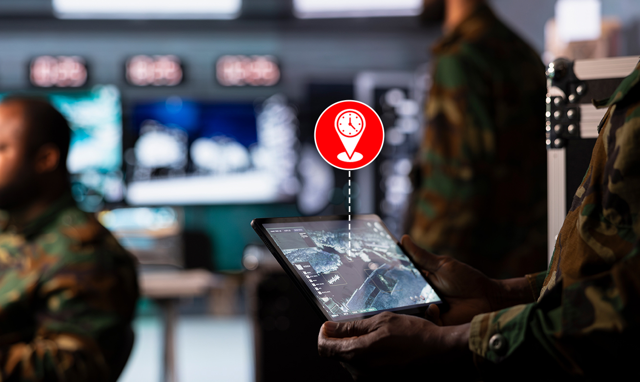
Monitor targets, assets, and areas of interest through active and passive location intelligence capabilities, enabling real-time visibility, continuous tracking, and historical location playback across multi-network environments.
- AI-Driven Predictive Intelligence
Leverage AI and machine learning to identify movement trends, detect anomalies, forecast hotspots, uncover behavioral patterns, and generate predictive intelligence from historical and real-time geospatial data.
- Geo-Fencing & Automated Alerts
Create virtual boundaries and configure rule-based alerts to detect location events, monitor restricted zones, and enable proactive response to evolving operational situations.

- Target Profiling & Behavioral Analysis
Build comprehensive target profiles by analyzing location history, movement behavior, travel patterns, and geospatial activities to support investigations and intelligence operations.

- Link Analysis & Association Mapping
Identify relationships between individuals, devices, locations, and events through integrated link analysis, enabling investigators to uncover hidden networks and coordinated activities.

- Multi-Source Data Integration
Integrate location intelligence from GMLC, SMLC, LMF, passive probes, GIS platforms, subscriber databases, and external intelligence sources within a centralized investigative and case management environment.

/How It Works/
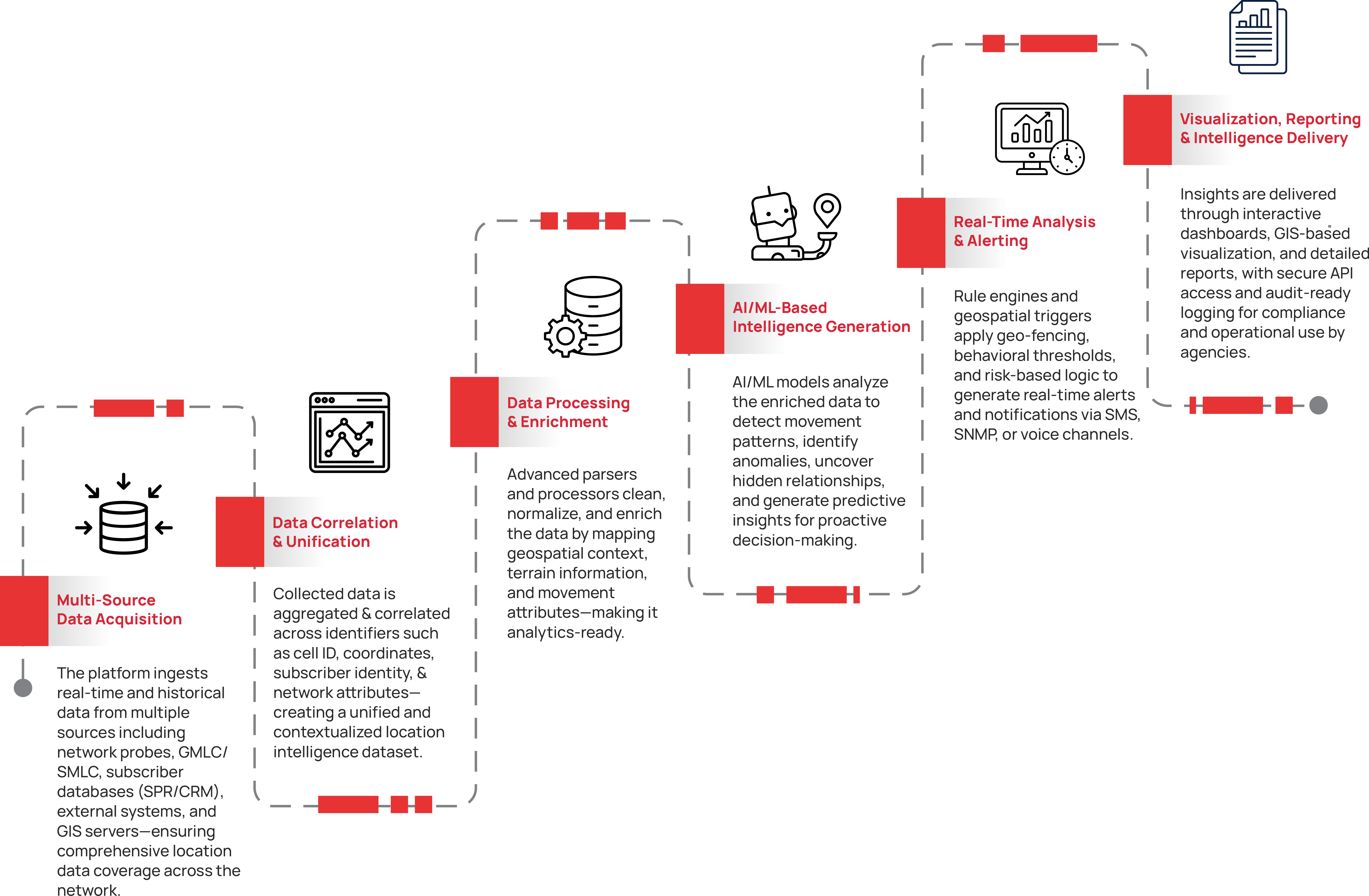
How the Solution Works

/ What Sets Us Apart /
The PertSol Advantage
Advanced AI-ML Intelligence
Leverage advanced machine learning models to identify anomalies, uncover behavioral patterns, and generate actionable intelligence from vast volumes of geospatial data in real time.
/ Certifications /
Certifications That Reinforce Trust












/ Related Solutions /
Explore More Solutions



Ready to Turn Location Data into Actionable Intelligence?
Connect with our experts to explore how PertSol's AI-ML Location Intelligence Platform delivers predictive insights, real-time visibility, and geospatial intelligence to support faster decisions and mission-critical operations.